European Union Agency for Railways
The European Union Agency for Railways (ERA) has been established in 2004 to devise the technical and legal framework for creating a Single European Railway Area (SERA) as mandated under European Union law. ERA’s core activities are creating a harmonised approach to safety, removing technical barriers, advancing the single European Train Control and Communication System (ERTMS), and promoting simplified access for customers for the European rail sector.
With the entry-into-force of the technical pillar of the 4th Railway Package, the mandate of the Agency has been extended. As of June 2019, ERA will be a European authority responsible for issuing vehicle authorisations and safety certificates in the European Union, as well as pre-authorising ERTMS trackside equipment.
Members
")


TENtec GISCO
TENtec
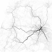
TENtec is the European Commission’s Information System to coordinate and support the Trans-European Transport Network Policy (TEN-T). The dataset contains linked data that is transformed from shp files. The dataset is a representation of the Trans-European Transport Network and contains interactive multifunctional maps (including thematic layers, base maps, search engine, print-outs etc.).
The query below shows a part of the dataset, namely the Baltic States covering Estonia, Latvia and Lithuania. The rest of the European Union is also available in the dataset, and can be queried as well.

Dutch data (Imspoor)
Introduction
A dataset that fits the bill nicely to also be transformed from the relational data to graph data is the the dataset from Prorail called IMSpoor. De IMSpoor dataset is a dataset that contains all the information about railroad tracks in the Netherlands.

Matching-Norway-data
Matching data from RailML Norway to the ERA knowledge graph.
Goal is to map the linked data from the RailML Norway dataset to the ERA knowledge graph. To do this you can use 4 different methods, going down from accuracy.
- Adminstrative linking, using an administrative code or number that can link two entities from different datasets. This is the strongest link.
- String matching, using strings, such as labels to match. This can be effictive as there is less room for small differences as the two below, but this method is sensitive for typo's and different spelling of names.
- Geo matching, using geocoordinates to match, this can work, but here different geosystems and different accuracy, could mismatch objects.
- Circumstantial evidence, this method can be effective, but is most of the time, time consuming and hard to maintain. This method is also sensitive for mistakes, and there is no default way of linking base on circumstantial evidence.
At the moment the dataset from Norway does not have an administrative link. The designators are not available in the RailML Norway dataset. Thus we can skip that matching strategy.
So instead we will try three different matching strategies.
Open Street Map
The data story describes the possibilities of open street map data transformation into linked data and further connection it with ERA KG.